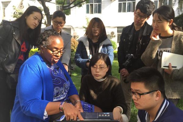
Students at one university in China are becoming very familiar with a New Orleans neighborhood thanks to a recent collaboration with University of New Orleans Department of Planning and Urban Studies associate professor Michelle Thompson.
Thompson, who is the project manager for WhoData.org, a web-based community mapping information service supported by the Department of Planning and Urban Studies (PLUS), traveled to Xi’An China in April to present a four-day workshop on the theory and practice of geographic information systems. In the process, the students learned about developing affordable housing to remediate blight in one section of New Orleans’ Central City.
Thompson provided hands-on instruction to six graduate students from Chang’An University in the Shannxi Province of China April 11-14. She delivered the workshop in response to an invitation by Jianxin Zhang, a professor in Chang’An University’s Department of Planning, who had served as a visiting professor in UNO’s Department of Planning and Urban Studies during the 2015-16 academic year.
A certified geographic information services (GIS) professional, Thompson is an expert in the areas of applied geographic information systems, community development finance, urban public finance, housing, urban studies, American city planning, neighborhood and land use planning. When Zhang was at UNO, Thompson volunteered to be his contact and the pair met weekly to discuss customs, culture, politics and planning with the help of a graduate student who acted as an interpreter. Zhang, whose research is in urban design and transportation, saw an opportunity for his own students to benefit from Thompson’s expertise on geographic information systems.
Thompson introduced the Chang’An students to the theory behind GIS systems and walked them through the process of how to conduct spatial field research, use disparate sources for validation, analyze, report and present the data using standards found in Citizen Science. Thompson provided 2016 property condition survey data that is being updated in New Orleans as part of a WhoData project focused on Central City’s Hoffman Triangle.
With the translation help of Tong Shen, doctoral candidate from the Chang’An College of Architecture, students created a unique data subset of property record profiles that will be a means for WhoData to monitor property development changes over time. NOLA Community Development Department provided funding for the Neighborhood Development Foundation to develop 13 historic affordable houses on formerly vacant and blighted properties in Hoffman Triangle.
Thompson will use this crowd-sourced data in UNO PLUS service-learning courses in the 2017-18 academic year to help develop a neighborhood asset and quality of life profile for Hoffman Triangle. Thompson said the workshop provided “an innovative group project and a new collaboration” between Chang’An and UNO.
“The research team is poised to make a significant contribution to the planning literature, document a process that has not been completed before and provide a new citizen science planning model through this longitudinal study started in 2011 by WhoData,” Thompson said. New Orleans Mayor Mitch Landrieu’s Blightstat process provides a contemporary look at the intersection of place-based neighborhood planning, blight remediation and affordable housing development.


